Scientists map seabed 'to inform policy and security'

 UKCSM
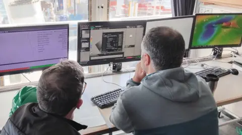
UKCSMScientists are exploring and mapping an area of seabed off the Cornish coast.
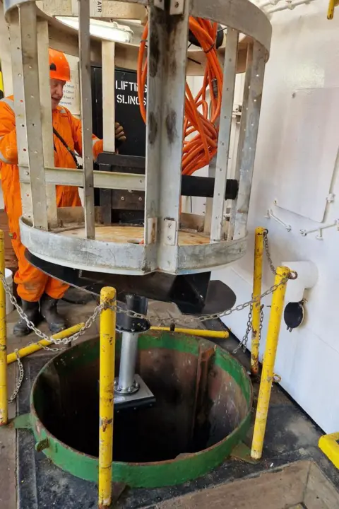
A four-week survey has been designed to collect hydrographic, geological and environmental data to help inform how the seabed is managed.
The UK Centre for Seabed Mapping (UKCSM), a group of more than 30 public sector organisations, said 26 scientists on the research vessel Cefas Endeavour were collecting data.
This will go on to be used in the fields of offshore energy, marine ecosystem science, safety at sea, marine policy and national security, UKCSM said.
 UKCSM
UKCSMAndrew Colenutt, chair of the project team, said it was exciting because it was the first time "such a large-scale, multi-agency, collaborative survey" had been undertaken in the UK.
"Such valuable datasets are increasingly underpinning the maritime economy and energy security, enabling sustainable management of marine resources, development of marine policies and planning, and improves our understanding of the marine environment," he added.
The project consists of two survey legs, which began in Lowestoft, Suffolk, on 20 April and is set to end in Falmouth on 19 May.
Alison Pettafor, co-chair of the project team, said the project "clearly demonstrates the benefits of a 'collect once, use many times' approach".
She said the collaborative survey was about "combining expertise, sharing data openly and building a clearer picture of our marine environment to support better decisions for the future".
 UKCSM
UKCSMA total of 11 UKCSM member organisations are involved:
- Maritime and Coastguard Agency
- UK Hydrographic Office
- British Geological Survey
- Centre for Environment, Fisheries and Aquaculture Science
- Department for Environment, Food & Rural Affairs
- The Crown Estate
- Historic England
- Joint Nature Conservation Committee
- Agri-Food and Biosciences Institute, Northern Ireland
- Natural England
- Royal Navy
Follow BBC Cornwall on X, Facebook and Instagram. Send your story ideas to spotlight@bbc.co.uk.
