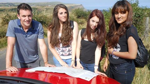
In this video three students use their map reading skills to navigate in an upland location in Yorkshire.
Video
Joe: Today, we're in the spectacular Yorkshire Dales, a national park to the north of Leeds in the central Pennines. I'm with Isaac, Ruby and Eddie. They've been blindfolded for the last part of our journey, so they've no idea where they are. That's because I want them to use a map to identify their location, and then follow a route that poses a tricky navigational challenge. It doesn't help that these 16-year-old, A-level students are map-reading novices, more used to finding their way around the streets of Leeds where they live. The road sign will tell them exactly where they are, but I'm keeping them the wrong side of it. They're going to have to use a bit of initiative to pinpoint their location. So have a good look around you. What can you see that we can find on this map?
Ruby: There's like some mountainous…
Joe: Yeah, you can see some rocks up there. A steep bit of the hill. Exactly. We've got a vehicle coming past us which is on a…?
All: Road
Joe: Road, very good. Road? So we've got a few key things. Anything else? What's the vehicle just gone over?
Ruby: A bridge.
Joe: Bridge is over a…?
Isaac: Stream.
Joe: Stream. We're somewhere on this section of map. Any idea where we could be?
Isaac: I'm looking for the bridge. I can't find the bridge.
Ruby: It says something about…
Isaac: Bridge.
Ruby: Marsett Bridge there. Ooh, and there's a telephone box which is…
Joe: Can you see a telephone box?
Ruby: There.
Joe: Yeah, very good. OK. They've made a good start, and we know that they're right but I want them to work a bit harder to confirm it and I've something that can help them. I'm going to give you this.
Eddie: Compass.
Joe: A compass. A compass allows us to identify which direction is north, and maps are always drawn up with north at the top. Can you make the compass face north and then orientate the map so north on the map is north in real life?
There is a small difference between magnetic north as shown by the compass, and grid north as shown on the map, but for this part of the task that difference isn't significant. Combining the map and the compass, allows the students to verify the relative positions of the features they've spotted.
That's north. That's what we're looking at. So what's north of this bridge?
Eddie: You see those sort of rocks around Sheepfold there?
Joe: Where would the stream be?
Isaac: There.
Joe: And the telephone box is on the other side of the stream. So, you think we're where? What's it called?
Eddie: Marsett Bridge.
Joe: Look at this. Ta-dah!
Ruby: Wow.
Joe: Right gather round. Let's have a look at where you're going to go.
I want them to follow a route that will take them up a hill, past a farmhouse, and through a succession of fields. At a crosswords, they should keep on the same path and text me when they get to a clearly marked Roman road. Happy? Yeah happy. Off you go. Good luck. Don't get lost! Our helicam will show how the features on the ground are reflected on the 1:25 000 scale Ordnance Survey map the students are using.
Ruby: Right, we're on the footpath at least.
Joe: The beginning is pretty straight-forward an easy walk up the hill. But, a significant navigational challenge awaits them.
The path leads straight up to a small farmhouse. At this point it divides. To the left there's quite an obvious path, but it's the wrong one. The correct path to the right is more difficult to spot and it leads steeply uphill to a small gate. Ah! Their first mistake.
Eddie: Now, that way.
Joe: They've carried on straight instead of bearing right.
Isaac: Why are we still walking?
Eddie: Why are we walking? Turn around!
Isaac: Turn around cos that's the…
Joe: Then they make a series of errors, because there are plenty of paths to choose from and they aren't following the map closely enough.
Ruby: This is someone's house.
Joe: The correct path heads uphill and cuts through a wall due north of the corner of a farmhouse. They miss it several times…
Ruby: I think we should head back…
Joe: before Ruby eventually spots the correct route.
Ruby: Is there a gate up there?
Isaac: Loads of buildings here.
Ruby: Is that a possible walk-through gate?
Isaac: Can you walk through there?
Joe: Through trial and error, they're back on track.
Ruby: Public footpath! Yes!
Eddie: Hello sheep.
Joe: The contour lines on the map show they now face a steep walk although this part of the route is straightforward as regards navigation.
Ruby: This is where we cross the stream. We're there. And then the gate's over there.
Isaac: Yeah.
Joe: The terrain, though, can be difficult in places. The right footwear is essential.
Ruby: Oh my God!
Eddie: Nearly!
Joe: The route goes through a series of walls marked by black lines on the map, which helps them keep track of exactly where they are. Features such a sheep folds, extra sections of wall used to pen sheep, are useful navigational aids.
Eddie: We've just gone through that wall there.
Ruby: .Yeah I think so.
Eddie: So, we just need to carry on.
Ruby: Let's march. Signpost!
Joe: There's a sign at the crossroads, but it only indicates three directions, so they'll need to use their initiative and close scrutiny of the map.
Eddie: There across.
Isaac: So, does that mean that this path just carries on straight ahead? I can't see where it goes to. Let's go up there.
Eddie: And then go…right. Follow the road down.
Isaac: Okey dokey!
Joe: They've taken the wrong path. On the ground, the right route is hard to spot, but it's clearly visible from the air. Instead, they've headed for the Roman road on the clearly marked bridleway indicated by the signpost ignoring their map. They then turn right at the road. It's been an unnecessary detour. At least they think they've found the right meeting place, but I have a way of confirming it using a GPS tracker, which can give us our precise location via map co-ordinates.
What we've got these two numbers here, are grid references OK? These co-ordinates give us an exact location. For mapping purposes, the UK is divided into separate 100km squares. The letters in our co-ordinates, tell us which one of these squares we're in. They can be found on the top of Ordnance Survey maps. In our case, it's SD. Each of these sections is then broken down into further 1km squares marked by blue lines on maps and referenced by numbers on the top of the map called eastings and on the side which are called northings. Eastings always come first. In our case, we have 88 referring to the major blue line. Then we hone in using decimal places, with the six two and three. We do a similar process with the northings, and that give us our exact location. GPS is very precise. In map reading, we normally use a six-figure reference which in our case would be: SD886872. These six-figure grid references locate a place to the nearest 100m. It would be very easy to follow that bridleway and come out a little bit further along but you've come out here so well done.
Eddie: Well, we did come out there…
Joe: Oh you did!
Ruby and Eddie: Yeah.
Eddie: And then we walked down here.
Joe: Oh right. OK.
Now there's one more leg to tackle. I want them to follow a path that takes them, onto Wether Fell and when they're due north of the highest point in the fell marked by what called a spot height, which is in metres, I want them to use their compass and head south straight for the summit. Our final meeting point, is a gate on the Roman road.
Eddie: It's kind of cold up here.
Ruby: That's why I put my coat on.
Joe: When they get onto the fell, there's something they need to look out for. This footpath is a public right of way, which means it's open to all people at all times of the year. And this land just over here is what's called access land. It means you do have a right to roam across it whether there's a footpath or not. It's marked on a map with an orange boundary, and a yellowish tint. However, just occasionally there can be restrictions when there's no open access. Those restrictions will be displayed on a notice board locally like this, so it's really important that Isaac, Ruby, and Eddie check this as they travel through.
Restrictions are put in place for various reasons, including the protection of wildflowers, or to avoid bird shoots.
Eddie: So just going straight on, aren't we?
Ruby: Going straight on?
Eddie: Let's go!
Joe: Isaac, Eddie, and Ruby totally ignore the notice board. Luckily, there are no restrictions today. If there had been, straying off the footpath, would mean they were trespassing.
The path runs around the edge of the fell, through a small disused quarry. The map gives them clues about where they need to head south, directly towards the summit. It's close to where the wall deviates away from the path, and just across a small stream. But, will they be observant enough to spot this?
Isaac: We already passed the quarry.
Eddie: Yeah, we've just gone past that, because that's the spring. Yeah, cos the wall goes…like that which is that.
Ruby: Apparently, north is that way.
Eddie: So we need to go south.
Isaac: Which way's south?
Eddie: That way?
Isaac: That way.
Joe: They're now relying on the compass to navigate, because the summit is hidden from view. It's a relatively short distance, so the difference between magnetic and grid north, doesn't matter. Their main tasks are to keep following the compass and keep their footing on the very boggy ground.
All: LAUGHTER Ugh!
Eddie: Can we not walk through it?
Ruby: Argh!
Joe: They've followed the compass perfectly, and reached the top of the hill directly in line with the summit which is marked on the map by a cairn, which is a pile of stones. Then it's a short distance down hill to end a 4.5km walk in, which they've got to get to grips with using a compass and map co-ordinates. Hey guys. How's it going?
All: Good.
Joe: Well done, you made it. This is the end.
Eddie: We did it!
Isaac: So happy now.
Joe: How does that feel?
Ruby: Great.
Joe: How did you find the last bit, particularly navigating with a compass, no bridle ways no footpaths just open land?
Ruby: It was weird but it was really fun.
Eddie: It was probably the best bit.
Joe: Was it?
Isaac: Yeah.
Joe: Very good. And in some ways the most challenging, cos you had to actually make sure you got your bearing right. Just a little bit out and you could end up miles in the wrong place. Well done. It was a tough uphill walk so come on then. Well Ruby Isaac and Eddie have done really well today. OK, a few mistakes near the beginning, which got them a little bit lost, but when it came to using a compass, to navigate across open land to a finish point that they couldn't see they absolutely nailed it. Brilliant stuff.
Download/print a transcript of the video.
Three students use a combination of observational skills, a compass, and map symbols to work out their location in Yorkshire.
Presenter, Joe Crowley, then asks them to use a map and a compass to find their way to the next destination. He explains how a compass can be aligned to a map to help navigate and explains the difference between Magnetic and Grid North.
The teenagers face a walk up a steep hill, marked by contour lines which are close together. They learn the difference between a bridleway and a footpath, how to use grid references on a map. The next stage of the challenge sees them using their compass and spot heights to find their way. Following the compass perfectly the trio pass a cairn and meet Joe at the final destination.
This clip was originally from the series Get Lost.
Teacher notes
Download/print the Teacher Notes for this episode (pdf).
Before watching the video
Ask students how features can be located on a map. Show students a range of different maps at different scales, for example a 1:25,000 map and a map of the world. Ask students if how they would find a location would differ between the maps.
Show students a range of map symbols and ask whether they can identify what the symbols are representing.
Introduce key terms such as:
Orientate: Align a map with its corresponding real-world position.
Navigation: The skills and knowledge needed to find a location and travel there.
Contour lines: Lines on a map which show areas of equal height.
Spot heights: A specific point on a map where the exact height above sea level is indicated.
During the video
You may wish to stop at relevant points during this short film to pose questions and check understanding or wait until the end.
Useful questions might include:
- Why is it important to be able to read symbols on a map?
- What is a compass used for?
- What is the difference between grid north and magnetic north?
- What is a 1:25,000 scale map?
- Why can map reading be difficult?
- What do contour lines indicate?
- Why are grid references important?
- Why is it important to use a map and compass together?
After watching
Use OS maps with your class asking them to pick out different locations on the map using grid references. Four-figure grid references could be used first and then six-figure grid references once students feel more confident. Students could then pick out 10 grid references on the map to test their peers with.
Students could also plan routes between two locations using grid references. They could describe the route between the two using geographical vocabulary, including compass directions.
1:25,000 and 1:50,000 maps could be used to show the differences in scale and how grid references can be used in the same way across both scale maps.
If you have the opportunity to take students outside of school, this would be a great opportunity to get students practising using a map and applying to the real world.
Where next?
The Ordnance Survey website provides a great opportunity to practice different skills and gain helpful hints and tips on all aspects of map reading.
Curriculum notes
This clip will be relevant for teaching Geography.
This topic appears in OCR, Edexcel, AQA, WJEC KS4/GCSE in England and Wales, CCEA GCSE in Northern Ireland and SQA National 4/5 in Scotland
More videos from this series
Map reading challenge on the moors. video
Three students complete a navigational challenge in a moorland location, using traditional map reading techniques.
Map reading challenge on the coast. video
Three students complete a navigational challenge in a coastal location, using traditional map reading techniques.