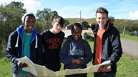
Three students use their map reading skills to navigate in a coastal location in Yorkshire.
Video
Joe: Today we're in North Yorkshire, on the Heritage Coast. I'm with Abi, Irum, and Sarah. They've been blindfolded for the last part of our journey, so they haven't a clue where they are. I spy with my little eye something beginning with S.
Sarah: Sky.
Joe: It's the start of a mission, in which these three 15-year-olds from urban Leeds, who think they know map-reading skills, will be asked to identify locations and follow a route between them. Any idea at all where you are at the moment?
Abi: No. In a field.
Joe: The first task is to use an Ordnance Survey map to pinpoint where they're starting… and you are somewhere on this map. So, what can you see - what can you see when you look around? Just talk me through the landscape as you see it right now.
Abi: Like, you see like the thing, sticking out the edge.
Joe: You've got some cliffs. What do you think this is?
Irum: Factory?
Abi: Yeah. A factory.
Joe: It does it looks industrial, doesn't it? It's big.
Sarah: Are we near here?
Joe: Right, what does that say?
Sarah: The jetty.
Joe: Jetty, very good. Is that sand down there?
Irum: Yeah.
Joe: What else can we see that you've spotted around us here?
Sarah: Is that the industrial area?
Irum: Industrial area it says 'works'.
Joe: The girls have found the only place on the map with a jetty, a sandy beach, and a large factory overlooking them. It puts them close to the village of Skinningrove - but what's their precise position? What's along this road that might give us a clue? These black lines here these are the edges of fields - these are the field boundaries, and we can see right here we're on the boundary between two fields. So that's exactly where we are. There's a key to everything here –so if you see anything on the map you don't understand, this is the place you look it up.
To start with, I want the girls to navigate down the coast to a rendezvous point close to a communications mast. When they think they've got there, I've asked them to send me details of where they are. They can do this using coordinates. Each place on the planet can be identified using latitude and longitude. Latitude indicates your position relative to the equator. Longitude tells you your position relative to the prime meridian, which runs through Greenwich in London. Combine the two, and you can pinpoint an exact location and the GPS tracker works this out for you. Here you go - you've got your latitude longitude. I want you to text me your coordinates…
Sarah: OK.
Joe: when you get to where you think, we're going to meet all right? And I'll come and see you. I'll start you off, you're going that way.
Irum: That way - OK.
Abi: Thank you.
Joe: See you later.
Abi: OK so we're here…
Joe: Look out for traffic. Our helicam is on hand to show how the map relates to the features on the ground as they take on the challenge. The girls need to finds a long distance trail called the Cleveland Way. On the 1:25 000 scale map they're using, public rights of way are marked as green dotted lines, and the long distance trails are signified by green diamonds.
Abi: We're here so we need to walk down there and find the path.
Joe: There's a short cut they can take - but will they see it? No - they've missed it.
Abi: I'm sure it isn't down there!
Sophie: Well is it past there?
Irum: Is it near the beach?
Joe: Now, this is interesting - the girls just walked past this spot, but they could have turned right here. As you can see, it's not that obvious, which is probably why the girls missed it. But when you're map-reading, it is so important to keep your eyes peeled for the small details.
The road continues downhill. Double arrows on a map indicate a steep gradient. Unfortunately, the girls follow it right to the bottom.
Irum: We're not going on the beach.
Abi: It's up the hill. Something's gone wrong.
Irum: Wait, can I see the map please?
Abi: Yeah.
Irum: So, it's up there.
Joe: When they find the path, it's a tiring climb back up to where they would have been, if they missed the short cut.
Sarah: That's like a 90 degree angle.
Joe: There are no arrows on footpaths to indicate they're steep, but you can tell from the map it will be tough going. The map is full of contour lines which connect points of equal height, marked on as a number, which signifies metres above sea-level. Cross contour lines and it means you're going up or downhill, and the closer they are together, the steeper the gradient.
YODELLING
Joe: From the hill, the girls get a clear view of features shown on the map. There's a red warning beacon… and the cliffs and wave-cut platform which run along this stretch of coast.
Abi: Where are we?
Irum: Um let's check. OK so we are about…
Sarah: Here.
Irum: Yeah. OK cliffs…
Joe: A good idea when you're navigating, is to turn the map in the direction you're walking - just like you're following a sat nav. Of course, it will mean the writing on the map could be at a strange angle, but it'll make it much easier to work out when and whether you have to turn left or right.
Abi: We'll just be, like, following it along the edge again.
Irum: OK. Look, it's the mast! So, we're nearly here then. Let's check the map.
Abi: Through there
Irum: and then there should be a footpath.
Joe: The girls think they've identified the path that leads away from the coast to the mast. If they're right, they should see a couple of archaeological features in an adjacent field, which are marked by italic writing. The map key reveals these are non-Roman sites, some have specific names but in this case each one is marked on as a tumulus - the technical term for an ancient burial mound. Then the path leads straight onto a communications tower.
Abi: This is like a eureka moment. Now we just have to work out how to open the gate.
Irum: We should text Joe.
Sarah: Yeah.
Irum: Tell him the coordinates.
Sarah: You do it.
Irum: OK one minute, I've got it.
Abi: North…
Irum: North…
Abi: 54 degrees…
Irum: 54 degrees…
Abi: 33…
Irum: 33…
Abi: 45
Irum: 45
Joe: Right, guys – clearly you're by a big radio mast here. Do you think it's the right radio mast? Think so.
Sarah & Abi: Hopefully.
Joe: Hopefully. If you've got a smartphone or a tablet, you can double check your location using a digital map. So, on this phone, I have downloaded software of the map. Now, it's the same map as you've got there, it's Ordnance Survey, but obviously if you press this button here, it actually locates you. And sure enough that orange bit is the checkpoint I sent you, and you can see this circle is where we are - so you are bang on. You are in the right place. Congratulations!
Irum: Yay!
Joe: Now, they need their final destination. I want them to meet meat the lifeboat station, which is located at an area called Cowbar, next to the village of Staithes. The Cleveland Way runs over the clifftops above old quarries. A cliff can't be shown by contour lines - instead you'll find a map symbol which indicates a vertical face.
Now maps don't just include landscape features - buildings are on there too. Over there is Boulby Mine and it's clearly marked on this map - not just because there's a mine there, but individual buildings are shown too. So, you can spot all sorts of things on a map of this scale. Farmhouses, factories, even tiny little cottages. So, there's plenty to look out for, and this row of cottages is clearly visible on the girls' map. The girls are safely on the right track. Now, it's a matter of following the road down the steep hill into the village. It's the end of an 8.5km walk.
Sarah: Can you see it yet?
Abi: There's an RNLI shop.
Sarah: Oh that!
Joe: Hello!
Abi: Oh!
Irum: We made it.
Joe: You made it! How you doing? Well done - this is the rescue boat you were looking for. So, congratulations - you have made it. So, come over here. Let's see that map - let's see the whole distance you've come then. So, you have walked from… Skinningrove all the way over there to Staithes, right in the middle. Quite a distance. How do you feel?
Irum: Wow.
Sophie: Tired.
Joe: Tired!
Abi: Relieved. Have you learnt, most importantly a little bit about map-reading?
ALL: Yes.
Joe: What sorts of things?
Irum: About how, like, to see where the rocks are, and when we're allowed to walk around with them and stuff.
Joe: Very good. So you're using the key to identify different features.
Abi: The gradients.
Joe: Yeah, crucial. The contours the ups and downs and reading those sorts of things.
Sophie: North's facing upwards.
Irum: It's always the same way.
Joe: The map is facing north exactly. Which way round to hold a map -very important that one! Congratulations. Well done guys. Good work. Probably time for an ice cream I reckon.
Irum: Yes!
Joe: Come on then. Sarah, Abi, and Irum have done really well. The girls have followed the map closely, they've noticed and hit all the major landmarks and they've arrived here in, their beautiful final destination on time and safely. I'd call that a job well done.
Download/print a transcript of the video.
Three students undertake a navigational challenge along the Yorkshire coastline.
Their first task is to locate their position, which they do using a combination of observational skills and map symbols and features. Presenter, Joe Crowley, then asks them to navigate to a meeting point a few kilometres away. He points out an approximate route, but the teenagers must use their initiative and the map to find their way.
The film shows map reading techniques like latitude and longitude, as well as map features like path markings. The students encounter a steep gradient on a cliff path, when contour lines are explained and illustrated. They pass ancient sites which they see on the map legend. They complete their challenge by meeting Joe in a seaside village and reflect on what they have learned.
This clip was originally from the series Get Lost.
Teacher notes
Download/print the Teacher Notes for this episode (pdf).
Before watching the video
Ask students how features can be located on a map. Show students a range of different maps at different scales, for example a 1:25,000 map and a map of the world. Ask students if how they would find a location would differ between the maps.
Show students a range of map symbols and ask whether they can identify what the symbols are representing.
Introduce key terms such as:
Navigation: The skills and knowledge needed to find a location and travel there.
Contour lines: Lines on a map which show areas of equal height.
Tumulus: An ancient burial mound.
During the video
You may wish to stop at relevant points during this short film to pose questions and check understanding or wait until the end.
Useful questions might include:
- Why is it important to be able to read symbols on a map?
- Why is it important to be able to read grid references?
- What is a 1:25,000 scale map?
- Why can it be difficult to map read?
- What do contour lines indicate?
- What is a key used for on a map?
After watching
Use OS maps with your class asking them to pick out different locations on the map and try to measure the distance between them. If it is a straight-line distance a ruler could be used, however if it is a not a straight line a piece of string can be used to wind between the points between the locations. This can then be held against a ruler to help measure a distance.
Students could also plan routes between two locations using different types of paths. They could describe the route between the two using geographical vocabulary, including compass directions.
1:25,000 and 1:50,000 maps could be used to show the differences in scale and how the distance between two points remains the same, despite the maps looking different.
If you have the opportunity to take students outside of school, this would be a great opportunity to get students practising using a map and applying to the real world.
Where next
The Ordnance Survey website provides a great opportunity to practice different skills and gain helpful hints and tips on all aspects of map reading.
Curriculum notes
This clip will be relevant for teaching Geography.
This topic appears in OCR, Edexcel, AQA, WJEC KS4/GCSE in England and Wales, CCEA GCSE in Northern Ireland and SQA National 4/5 in Scotland
More videos from this series
Map reading challenge on the moors. video
Three students complete a navigational challenge in a moorland location, using traditional map reading techniques.
Map reading challenge in the hills. video
Three students complete a navigational challenge in a upland location, using traditional map reading techniques.