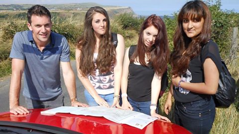
Map reading skills are put to the test in a moorland location.
Video
Joe: Today we're in Yorkshire, exploring the North York Moors. I'm with Danyaal, Haseeb, and Fezzy. They've been blindfolded near the end of their journey, so they haven't a clue where they are. It's the start of a mission in which these three 16-year-olds, from Batley in West Yorkshire, will be asked to identify locations and follow a route between them. It's a tricky task especially as the lads know little or nothing about map reading. Take a look around you. Do you have any idea where we are? Exactly where we are right now?
All: No.
Joe: OK, using this map, if I give you a slight clue, which is that we… somewhere in this section of the map, I want you to try and work out exactly where we are. And the first way to do that, is just to take a look around you. What can you see that we may be able to find on here to give us a clue?
Danyaal: Houses.
Joe: Houses, very good.
Fezzy: Valleys.
Haseeb: There's a telephone box.
Joe: A phone box!
Haseeb: Ah I found it.
Joe: Well, that's a phone box, so how do we know if it's the right one? What else do we know?
Fezzy: It's one road.
Danyaal: There's a path going down there and there's a path going up here. There's a straight road going up there.
Hurrah! We found it. Very, very good. I've set the lads a navigational challenge - to link up with an old disused railway track, which follows a line west of some mine workings. At a plantation of trees, I want them to head uphill. Now, there are two paths to choose from, I want them to take the most easterly of the two, and follow it up to a road. Happy?
All: Yeah. Thank you.
Joe: Very good. I'll start you on your way - you're going up the bridle path. Don't get lost yeah? LAUGHTER Right, see you shortly.
Fezzy: Yeah.
Joe: Our helicam is on hand to show how the map relates to the features on the ground, along the seven and a half kilometre route. Before the lads get into the open countryside, their route takes them through a farmyard.
Danyaal: Do we follow that path? And then we take that one there.
Haseeb: Yeah. It's still uphill.
Danyaal: Are you sure? Yeah.
Joe: Now, the lads, quite rightly walked straight through here. But some people might hesitate, cos when you look at it, it looks a little bit like you're walking through someone's back yard. However, if you study the map and there's clearly a green dotted line, ie a public right of way then you are fully entitled to walk straight through.
All: It has to be this. There's no other way. Look for some more clues that will tell us where we are.
Joe: A good map-reading trick is to look for features on the ground that you can see on the map. Spot them, and you know you're on the right track. The lads have identified a farm they can also see on the map.
Fezzy: What are them houses down there though?
Haseeb: It's Craven Garth Farm. Look we've just came from there. That's the road. There.
Danyaal: It's Craven Garth Farm.
Fezzy: Yeah well spotted. This is the path.
Danyaal: Must be the path.
Joe: Our helicam tracks the boys as they follow a route which takes them one side of a steep-faced valley - following the course of an old railway track, that served the iron mining industry on this part of the moors.
Danyaal: There's a sign here.
Haseeb: Alright.
Danyaal: So, check were we are on the map.
Haseeb: This is East Mines.
Joe: It's not long before they reach a spectacular example of industrial archaeology in the shape of old kilns. These kilns are plainly visible on the map. The ground rises steeply as shown by tightly packed contour lines. And the helicam can rise high enough, to see what the boys can't. A disused quarry and another old railway line that linked up with it. But there are other map features, that can help the boys pinpoint their location.
Haseeb: Florence Terrace. Look just there.
Joe: The real test though is coming up. Now, at the bottom of this hill there's a plantation, and there there's a path that branches off to the right. That's the one I've told the boys to take but, it's overgrown, and very tricky to spot ,so it's going to be interesting to see if they notice it.
Fezzy: We're on the High Gill now.
Danyaal: Right, we've got a big decision to make.
Haseeb: Look how many trees are there.
Danyaal: Millions.
Joe: The map features they're looking for, are a plantation of coniferous trees, and a path that runs down to Dale Head Farm where there's a tea shop. It's here, where they need to turn right.
Haseeb: Dale Head Farm Tea Garden.
Joe: They notice the path that runs down to the cafe…
Fezzy: I really want a cup of tea
Joe: …but don't realise its significance as a landmark. They continue on the railway line. Now, they're going the wrong way.
Haseeb: It has to be though.
Fezzy: Right, we're lost. THEY LAUGH
Joe: The boys realise they've gone wrong…
Danyaal: Where else is there?
Fezzy: Dale Head Farm is there.
Joe: …check the map…
Danyaal: It's there somewhere.
Joe: …and retrace their steps back to the right path.
Haseeb: We've just gone fully round.
Joe: They now face a steep climb, where the path disappears in places. It's on the map, but it's not clearly visible on the ground.
Fezzy: Come on boys, we're soldiers. No pain…?
Haseeb: No gain
Fezzy: Yes. Yes. No gain.
Joe: Now, at this point on the path there's plenty of potential for the boys to go wrong. One path very clearly defined, continues up the hill,but it's the wrong one. The correct path goes off to the right, but you can see it's really overgrown and very difficult to spot. The map-reading clue here, is that there's a stream just there. The correct path crosses the stream, whereas the incorrect path, goes AWAY from the stream. So if they're paying close attention they might just get it right.
Danyaal: I'm guessing it's straight up there.
Haseeb: Yeah just follow the path.
Joe: It's not surprising, that the boys do indeed take the wrong path again.
Fezzy: Where are we?
Haseeb: Is it up here? But Fezzy eventually realises they've made a mistake.
Fezzy: We need to take this route. You're taking the other route. Show me show me. I'm taking the east side route.
Haseeb: Show me show me then.
Fezzy: We're taking the west side.
Danyaal: Yeah he's right. Look we're taking that route.
Joe: And he puts them back on the right route - on the easterly path, that leads up to the roadside.
Danyaal: We're onto the path.
Joe: Hey guys, how's it going? You made it. How was that? And what about the map reading?
Both: Tiring. Tiring.
Joe: How did you find it?
Haseeb: We made two major mistakes.
Joe: Two mistakes?
Haseeb: It was an easy mistake to make.
Fezzy: We just took the wrong path.
Haseeb: There was not much of a path to walk on, so we took the wrong path.
Joe: Often, it's not obvious where a path is because unless enough people walk on it, it doesn't get trampled down. It's not that obvious. That's why you've got to look for geographical features, and just any clues that you can pick up along the way. Next, I want them to take a route across some heather-covered moorland. This route involves moving from one map to another. Thankfully, there's a way of linking them. Ordnance Survey maps are covered in a series of faint blue lines making up a grid. These lines are a kilometre apart and have numbers accompanying them, which you'll find on the edges of the map. The numbers running left to right are called eastings, the ones running up and down are northings. You need to look where a route leaves one side of a map, note the relevant easting and northing and match them up on the second map. The back cover will show you which second map you need. In this case it's OL27. You'll be coming up here. What does BP and BS stand for?
Haseeb: Is it a power station?
Joe: Good, good guess. It's not funnily enough, in the middle of grass a petrol station. Look at the key. Remember you can always look these things up. Where's BP and BS?
Fezzy: Boundary Post.
Danyaal: Boundary Stone.
Joe: Very good. I'm going to meet you at that road. Good luck guys.
All: See you later.
Joe: The route now leads across an expanse of open moorland. Moors can make it very difficult to pinpoint exactly where you are because feature scan be few and far between. So, you need to make a note of any that crop up on your route. In the lads' case, they know they're looking for a couple of boundary markers.
Haseeb: That's a BS and this is the BP.
Danyaal: Yeah go on. So straight on.
Fezzy: That's straight on.
Joe: The path is well marked here. Moors are often criss-crossed by old packhorse trails that were laid with stone to stop the horses sinking into the boggy ground.
Fezzy: We need to head right somewhere, don't we?
Haseeb: It's over there. As the mist starts to come in the boys see the hills opposite where they need to turn right.
Danyaal: Over there.
Joe: Soon, they move from one map to the other.
Fezzy: We've passed a few streams, and we came past that last stream over there. So we're coming off OL26 and we're going on to OL27 map. It overlaps.
Haseeb: That's it look.
Joe: And they're on the last leg to our final and very misty meeting point. Well done.
Haseeb: Thank you.
Joe: Congratulations! Put it there. You made it.
Haseeb: I know.
Joe: It's the end of a 7.5km walk that's taken the lads from a small, sheltered hamlet to an exposed stretch of moorland. What was the hardest thing today do you think?
Haseeb: I'd say we got lost twice, that was hard. We managed to get back on the right track.
Fezzy: Plus, you learned how to understand a map.
Danyaal: Yeah, I can understand a map a lot better now.
Joe: So, look you should bevery proud of yourselves. You feel good?
ALL: Yeah.
Joe: All right, come on let's go home. Well, the lads did go wrong a couple of times, but they kept their wits about them. They worked out where they had made a mistake, and they got back on track, and that's the key. If you keep checking where you are, and which direction you are going in, you won't go too far wrong.
Download/print a transcript of the video.
Three students complete a navigational challenge in the Yorkshire countryside.
Starting in a mystery location, they use a combination of observational skills and map symbols and features to identify their location. They are asked to follow a path on a disused railway track, past some mine workings to meet the presenter, Joe Crowley, a few kilometres away.
Along the way, they learn about rights of way, how to identify old mine workings on the map, how to use gridlines, and eastings and northings. They find their way across an expanse of moorland taking note of boundary posts and markers to help them.
This clip was originally from the series Get Lost.
Teacher notes
Download/print the Teacher Notes for this episode (pdf).
Before watching the video
Ask students how features can be located on a map. Show students a range of different maps at different scales, for example a 1:25,000 map and a map of the world. Ask students if how they would find a location would differ between the maps.
Show students a range of map symbols and ask whether they can identify what the symbols are representing.
Introduce key terms such as:
Coniferous trees: Trees which do not lose their leaves.
Grid reference: A system used to pinpoint locations on a map by using eastings and northings.
During the video
You may wish to stop at relevant points during this short film to pose questions and check understanding or wait until the end.
Useful questions might include:
- Why is it important to be able to read symbols on a map?
- What symbol is used for a footpath?
- Why is it important to be able to read grid references?
- What is a 1:25,000 scale map?
- Why can it be difficult to map read?
- What do contour lines indicate?
- What is a key used for on a map?
After watching
Use OS maps with your class asking them to pick out different locations on the map using grid references. Four-figure grid references could be used first and then six-figure grid references once students feel more confident. Students could then pick out 10 grid references on the map to test their peers with.
Students could also plan routes between two locations using grid references. They could describe the route between the two using geographical vocabulary, including compass directions.
1:25,000 and 1:50,000 maps could be used to show the differences in scale and how grid references can be used in the same way across both scale maps.
If you have the opportunity to take students outside of school, this would be a great opportunity to get students practising using a map and applying to the real world.
Where next?
The Ordnance Survey website provides a great opportunity to practice different skills and gain helpful hints and tips on all aspects of map reading.
Curriculum notes
This clip will be relevant for teaching Geography.
This topic appears in OCR, Edexcel, AQA, WJEC KS4/GCSE in England and Wales, CCEA GCSE in Northern Ireland and SQA National 4/5 in Scotland
More videos from this series
Map reading challenge in the hills. video
Three students complete a navigational challenge in a upland location, using traditional map reading techniques.
Map reading challenge on the coast. video
Three students complete a navigational challenge in a coastal location, using traditional map reading techniques.