Liz Bonnin introduces a clip examining the geology of the Jurassic Coast in southern England.
Video
LIZ BONNIN: Hi, I’m Liz Bonnin. I’m going to show you a clip that looks at one of the most fascinating stretches of our coastline. Running from East Devon to Dorset, it’s the Jurassic Coast.
With that name clearly we’re talking about a landscape that dates back to the time of the dinosaurs, rather than 1993 when the first Jurassic Park film came out. Although that is 25 years ago so it is getting on a bit.
Anyway, it’s an area that’s fascinating for geologists because rocks from three different eras, millions of years, are easily accessible to study. And here to explain why is Alice Roberts, with some cake.
ALICE ROBERTS: The extraordinary thing about this length of coastline is that it spans nearly 200 million years of Earth’s history. That’s three geological time periods.
And for that reason, in 2001, the United Nations designated the Jurassic Coast, a World Heritage Site. Alongside iconic places like, the Great Barrier Reef and the Grand Canyon.
In fact though, the Jurassic Coast is a confusing name, because along its 95 mile length, there are also younger, Cretaceous and older, Triassic rocks to be seen.
The Cretaceous rocks are at the Eastern end and were formed at the time some of the largest dinosaurs roamed the Earth.
Further along and further back in time are the fossil-rich Jurassic rocks created as the Earth saw an explosion of marine life.
And finally, at the far Western end, are the very oldest rocks of this heritage coast. The striking red Triassic cliffs were formed up to 250 million years ago.
What’s unique about this area is that these three geological periods, which together make up the Mesozoic era, are laid out next to one another. But the process that’s created them takes some explaining.
(Handed three slices of cake on a plate) Oh, lovely. Thank you. So I’ve got three slices of cake here in front of me. This first one is going to be the earliest rocks that we find along the coastline. The Triassic rocks that were laid down between 200 and 250 million years ago. And they’re red sandstone rocks laid down in the middle of a great arid desert.
The next layer is Jurassic. Here… We have a story of sea levels rising and falling and marine sediments being deposited. Limestone clays that sort of thing, lots and lots of fossils in this segment. And this is between 200 to 140 million years ago.
Finally, we have the most recent rocks that we see along this coastline, the Cretaceous rocks. And these are laid down in swampy environments. And those represent between 140 and 65 million years ago.
If that was the end of the story we’d be standing up here and we wouldn’t be able to see the Jurassic or the Triassic rocks underneath. So… In fact, what happened during the Cretaceous period, was that the whole thing sank down in the East. So that we end up with, in fact, all of these layers pointing up to the west end and then it is eroded.
So if I represent that erosion by actually cutting through the cake at an angle like that. And then what we’ve got is the land surface of today, and we start in the east here at Old Harry Rocks. And we walk through cliffs that are Cretaceous.
And then suddenly we find ourselves walking along Jurassic cliffs.
And finally, into the oldest rocks, the Triassic rocks until we get all the way to Exmouth at the end of this prehistoric walk along the coast.
(Eating the cake) And it is quite delicious.
LIZ BONNIN: Got that everyone? Cretaceous rocks between 66 and 145 million years old. Jurassic rocks between 145 and 200 million years old. And Triassic, as old as 250 million years. And all of them delicious.
Download/print a transcript of the video.
The 'Jurassic Coast' in southern England spans nearly 200 million years of Earth’s history and three geological time periods.
The clip explains the different rocks that can be found along this coastline - Cretaceous, Jurassic and Triassic - and why they formed. Slices of cake are used to demonstrate how the rocks have formed over time and how it is possible to see them all in the landscape.
Teacher notes
Download/print the Teacher Notes for this episode (pdf).
Before watching the video
Locate the Jurassic Coast on a map of the UK and ask students to write a locational description.
Look at images of the Jurassic Coast and the landforms found there and ask students how they think it was formed. Show images of the rock types and ask students why they think they are different.
Introduce key terms such as:
Geologist: A scientist who studies geology.
Geological time period: A division of Earth’s history based on significant geological events and rock formations spanning from Earth’s formation to the present day.
Erosion: The process where natural forces like wind, water, or ice wear away and transport soil, rock, and other materials from one location to another.
During the video
You may wish to stop at relevant points during this short film to pose questions and check understanding or wait until the end.
Useful questions might include:
- Where is the Jurassic Coast?
- How many years of history are evident along the Jurassic Coast?
- What types of rocks can be found along the Jurassic Coast, which periods do they come from?
- How long ago were the Triassic rocks laid down?
- What happened during the Jurassic period?
- What was it like in the Cretaceous period?
After watching
Discuss with students whether their predictions were correct about how the Jurassic Coast was formed. Look at a diagram of geological time periods to show the changes over time from Earth’s formation to present day, this will help students to see just how long ago this stretch of coastline was formed.
Compare images of the Triassic, Jurassic and Cretaceous stretches of coastline. What similarities and differences can be seen? Individual landforms such as Old Harry’s Rocks and Durdle Door could be picked out and the formation of those landforms could be discussed. Students could draw the different landforms and annotate them to explain their formation. The skill of drawing a field sketch could also be practiced.
A geology map of the Jurassic coastline could also be studied to find out more about the range of rocks found along this stretch of this coastline. Locations east and west of this could be examined to see how their geology is different to that of the Jurassic coastline.
Where next?
Along the Jurassic coast there are a wide range of famous coastal landforms such as Lulworth Cove, Durdle Door, Old Harry’s Rocks and Chesil Beach.
Students could investigate the range of landforms creating a storyboard or a flow chart of their formation using key geographical terminology.
This is a great opportunity for students to further their understanding of coastal processes and the impacts of geology on the coastline.
Curriculum notes
This topic appears in Geography at KS3 (Coasts) and KS4 / GCSE (Coastal landscapes) in England, Wales and Northern Ireland and National 4/5 in Scotland.
More videos from this series
What is the water cycle? video
Iain Stewart describes the water cycle including evaporation, condensation and precipitation.
How does a river change as it travels downstream? video
An archive clip of Sir David Attenborough as he follows the course of the Amazon River as it travels downstream.
The erosion of the Grand Canyon. video
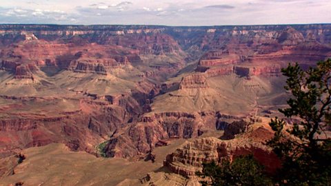
Liz Bonnin introduces the Grand Canyon - its ancient geology and what can be learned from the erosion of the rocks.
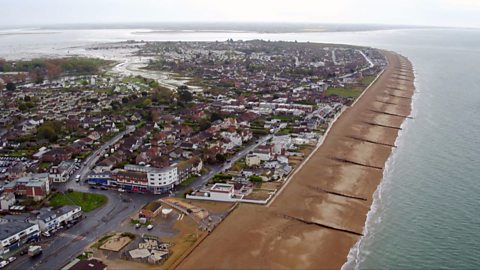
What coastal management techniques are being used on Hayling Island? video
Introduces the coastal management techniques used on Hayling Island in Hampshire to control drift and flooding.
What is a ‘spit’ and how does it form through longshore drift? video
Katie Knapman explains how a spit forms through longshore drift and is a dynamic physical process, constantly changing the coastline.
How have physical processes impacted the landscape of Yorkshire? video
Julia Bradbury explains the formation of Malham Cove including limestone pavement, highlighting the impact of glaciers on the landscape.
Glaciation and the UK coastline. video
Alice Roberts explains how Britain was once connected to Europe, but changed due to rising sea-levels following the Ice Age.
How has glaciation shaped the landforms of the Northern Hemisphere? video
Iain Stewart explains the glaciation of the Northern Hemisphere, focusing on the Yosemite Valley in California.
What evidence is there for climate change in the UK? video
Tom Heap considers the evidence that the UK climate might be changing - with more droughts, higher summer temperatures, but wetter winters.
How can plate tectonics impact oceans? video
Exploring how the plate tectonics impacts the coastline, focusing on California through study of the San Andreas fault.
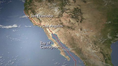
Plate tectonics in the UK - Anglesey. video
Nick Crane explores the geology and seismology of Anglesey - earthquake hot spot of the UK.
Deforestation and the growth of soya in Paraguay. video
Simon Reeves visits Paraguay to consider the deforestation that has occurred there to grow soy and the challenge of conservation vs development.